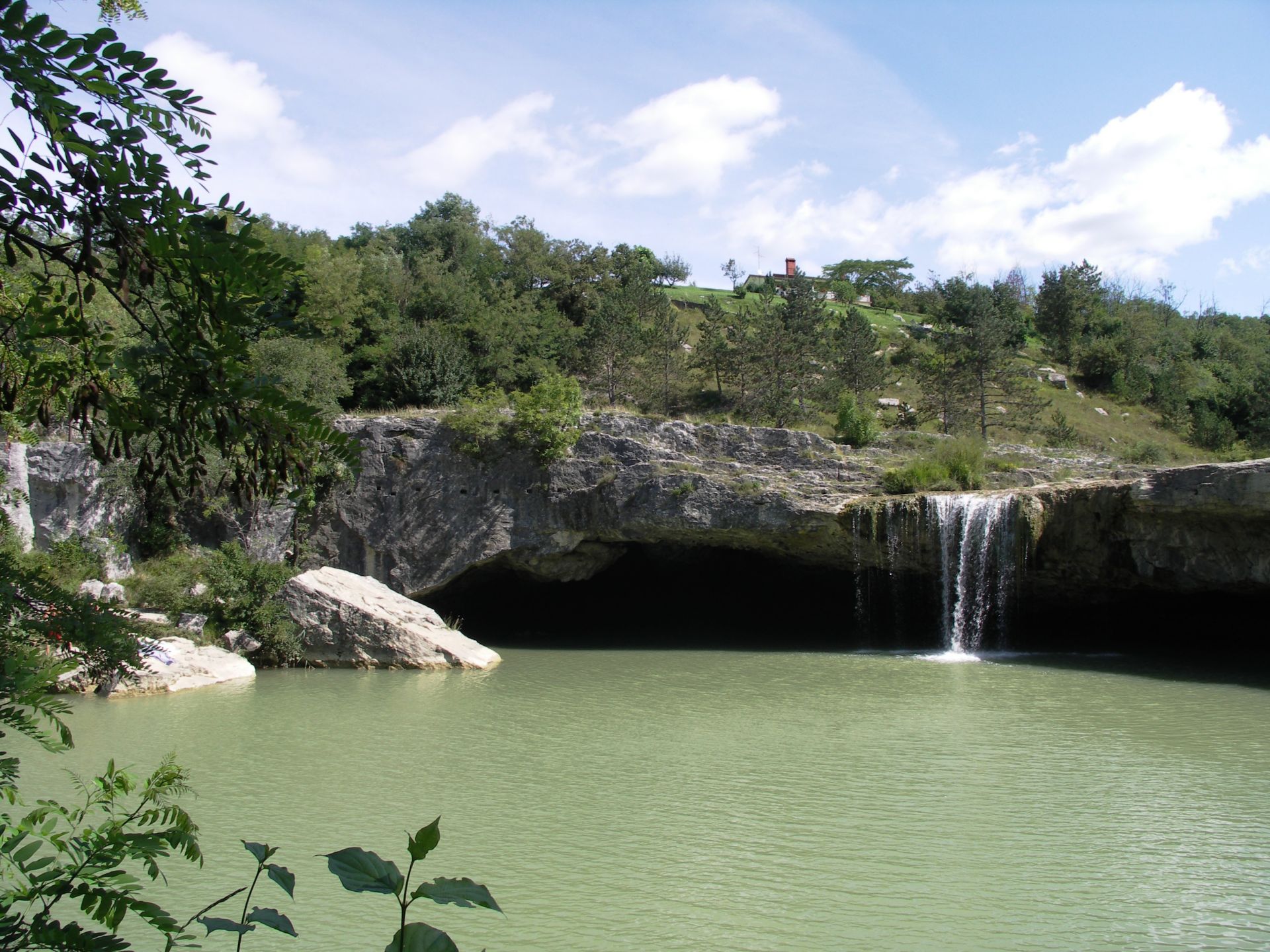
Pazin is a city situated in the very heart of the Istrian peninsula. Its climbing is divided in two sectors: Zarečki krov and Lido. Zarečki krov is a beautiful waterfall on the Pazinčica river. This is one of the most attractive waterfalls in Istria. The waterfall is falling down from a 10 meter high cliff into a small lake. Below the waterfall you will find an interesting half-cave, which is only dry during summer season. The sector Lido is closer to the city but the climbing there is more local style overgrown with trees and bushes and short routes, so it is not really fully recommendable.
ACCESS
Leave the motorway on Pazin – istok (east) exit and drive towards the town. There are two right turns on a straight, flat part of the road after passing under the railway bridge. Both of them lead to Zarečki krov waterfall and climbing place. For sector Lido follow the main road for another couple of hundred meters towards Pazin and then turn right in the direction of Kršikla. Stay on this road for about 300 meters, pass the bridge and park soon on your right side. This small sector is just below the parking space.
WEATHER
While Zarečki krov is perfect in summer mornings, climbing in sector Lido is possible all year round except summer.
ROCK QUALITY
The quality of the limestone here is pretty much the same as in all the other areas around – good.
INTERESTING NOTES
Pazin is a town of long and rich tradition. It is situated in the very center of the Istrian peninsula, only 30 km away from well-known tourist centers. The intensity of life here is pretty much the same in winter and summer. Pazin was made the administrative center of the Istria county, because it is located in the geographical center of the county and in order to boost the development of the interior of the peninsula.
ROUTES (from left to right)
In both sectors the routes are pretty short, while in Zarečki krov they are mostly very overhanging and in Lido they are fully slabby. Good maximum power and climbing technique are fully essential.
A/I – Zarečki krov
| Priroda i loše društvo | 6c+ | 10m |
| ? | 4c | 8m |
| ? | 5a | 8m |
| ? | 6b | 8m |
| Ćurka | 6b+ | 10m |
| Last action hero | 6b | 9m |
| Taši | 6a+ | 9m |
| Crveni patuljak | 6a+ | 7m |
| Laganica | 5b | 7m |
| Teži | 4a | 5m |
| Laki | 4b | 5m |
| Lakši | 4b | 5m |
A/II – Zarečki krov
| Infection groove | 8a | 12m |
| Oćo | 8b | 14m |
| Nerve | 7b+ | 8m |
| Breakdown | 7c | 10m |
| Vasiona | 7b+ | 15m |
| Vasiona extended | 7c+ | 25m |
| Panin | 8b+ | 31m |
| Easy ride | 8a+ | 16m |
| P | ? | 10m |
| P extension | ? | 17m |
| Sakrabojski | 7c | 16m |
| Sakramenski | 7b+ | 16m |
| Erectus | 7b | 15m |
| Buhalero | 6c | 8m |
| Pet punti | 7b | 8m |
| Dog cemetery | 7c+ | 8m |
| Kataklizma | 7c | 6m |
| Barijera | 6c | 8m |
| Čajanac | 7a+ | 10m |
| Kanešteta | 7a | 20m |
A/III – Zarečki krov
| Tu i sad | 6c | 10m |
| 4 godine čekanja | 7a | 10m |
| Sabotage | 7a | 20m |
B – Lido
| Virus | 5c | 8m |
| Alien | 5b | 8m |
| Predškolski | 5b | 13m |
| Školski | 6a | 13m |
| Pelica | 6b+ | 13m |
| Lido | 6a+ | 13m |
| Top secret | 7b+ | 13m |
| Durex | 5c | 13m |
| Hiperaktiv | 7a+ | 8m |
| Brain for dinner | 7a | 8m |
| Varijanta Kvazija | 6b | 8m |
| Kvazimodo | 6b | 8m |
| Road of illness | 7a+ | 10m |
| Srce | 6a+ | 12m |
| Ženskar | 7b+ | 12m |